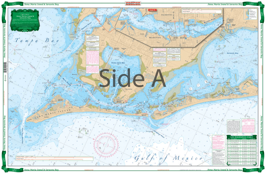
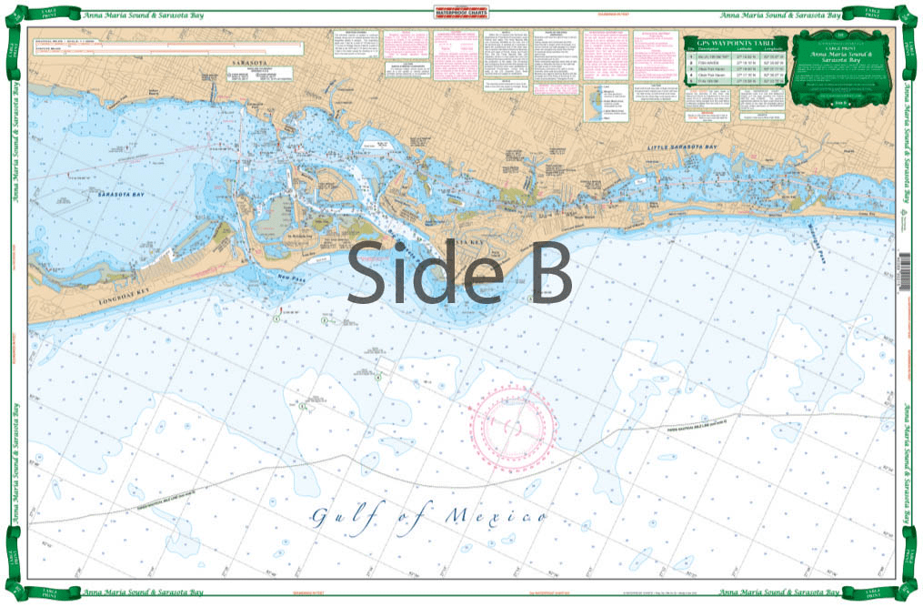

Very large blown up coverage from Anna Maria Island south to Little Sarasota Bays and up the Manatee River to Bradenton and Palmetto. Detail for Sarasota. Large Place names make areas easy to find. A total of 19 plotted and indexed GPS Waypoints make it easy to set up your electronics. Don’t go anywhere without this Anna Maria Sound and Sarasota Bays navigation chart! We use data compiled from 2 NOAA charts to give you a more comprehensive overview of this boating area. This nautical map has a very large blown up coverage from Anna Maria Island south to Little Sarasota Bays and up the Manatee River to Bradenton and Palmetto. Detail are also included for Sarasota. Large place names make areas easy to find, even when boating at high speeds! (Though we don’t recommend you read and drive). A total of 19 plotted and indexed GPS Waypoints make it easy to set up your electronics. Get a second copy of this navigation map. Why? Because you’ll love the vibrant colors so much you’ll get it framed and hung on your wall. Information from 2 NOAA Charts: #11425 and #11411. Nautical chart is 25″ X 38″. WGS84 – World Mercator Datum.


I had a great experience with ANS!
My charts were delivered super quickly, and their customer service was excellent—very responsive and helpful with any questions I had. Highly recommend them for anyone needing quality charts with fast and friendly service.
D.O.T. Chart 17 - Hazardous Materials Markings Labeling and Placarding Guide
Product exactly as advertised, order filled speedily, product arrived in excellent condition.
Exactly what I was looking for. Quick turn around best online price shipped.
My order was filled, shipped and received within a few days. They make beautiful ways to hold my charts down while I am examining and working with them. The chartweights are attractive additions to my navigation tools. I would recommend American Nautical Services very highly.