Collection: Nautical Charts

Nautical Charts

Nautical charts are available in two general formats: physical charts, which are printed on paper and electronic charts, which are displayed on an electronic chart display and information system (ECDIS). Each type of nautical chart may be purchased online or ordered over the telephone.

British Admiralty nautical charts are produced by the United Kingdom Hydrographic Office (UKHO) and have been updated to conform to the most recent notices to mariners. They conform to nautical chart carriage requirements detailed in in Safety of Life at Sea (SOLAS) Chapter V Regulation 2.2 and also meet the carriage requirements in SOLAS Chapter V Regulation 19.2.1.4.

Nautical charts and other information services provided by the UKHO are widely-regarded as standard-setting in the industry. British Admiralty nautical charts are designed to provide mariners with the most up-to-date nautical information and keep fleets in compliance with prevailing legislation; legislation that is intended to keep crews safe.

The U.S. National Oceanic and Atmospheric Administration (NOAA) also produces high-quality nautical charts that comply with SOLAS Chapter V Regulation 2.2 carriage requirements and also meet the carriage requirements in SOLAS Chapter V Regulation 19.2.1.4. NOAA nautical charts are printed "on-demand" so that they are updated to include the most recent information available.

NOAA nautical charts have an equally impressive provenance and are highly regarded for their accuracy, ease-of-use and durability. NOAA charts are printed on water resistant paper, which is specifically designed to stand up to wet and damp maritime environments.

All nautical charts available are updated to include information provided by NOAA and UKHO as reported in notices to mariners. It is important that mariners with carriage compliance requirements stay aware of subsequent notices to mariners and update their chart libraries accordingly.

British Admiralty charts produced by the UKHO and NOAA nautical charts are available for a range of locales. Browse the entire selection of British Admiralty and NOAA nautical charts that are available. Mariners are bound to find the nautical chart they need to stay safe and compliant in the list of titles available online from British Admiralty and NOAA nautical charts. No matter where your voyage will take you, British Admiralty and NOAA have the charts you need to plan a successful passage and remain compliant with your flag state's nautical chart carriage requirements.

Filter by
34 of 7442 products
S1 - Southern Coasts of South America S1 - Southern Coasts of South America Clear all
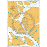
British Admiralty Nautical Chart 4274: Golfo de Ancud
Price
$55.95
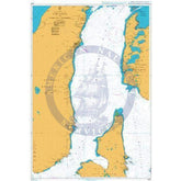
British Admiralty Nautical Chart 4263: Paso Ingles
Price
$55.95
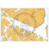
British Admiralty Nautical Chart 4273: Chile, Seno Reloncavi
Price
$55.95
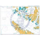
British Admiralty Nautical Chart 4272: Chile, Eastern Entrance to Canal Chacao to Seno Reloncavi
Price
$55.95
British Admiralty Nautical Chart 4271: Chile, Canal Chacao
Price
$55.95
British Admiralty Nautical Chart 3335: South America - East Coast, Puerto Santa Cruz to Estrecho de Magallanes
Price
$55.95
British Admiralty Nautical Chart 3334: South America - East Coast - Argentina, Puerto Deseado to Puerto Santa Cruz
Price
$55.95
British Admiralty Nautical Chart 3332: South America - East Coast - Argentina, San Gregorio to Puerto Deseado
Price
$55.95
British Admiralty Nautical Chart 3331: South America - East Coast - Argentina, Punta Delgada to San Gregorio
Price
$55.95
British Admiralty Nautical Chart 3330: South America - East Coast – Argentina, Segunda Barranca to Punta Delgada
Price
$55.95
British Admiralty Nautical Chart 3006: Chile, Estrecho de Magallanes
Price
$55.95
British Admiralty Nautical Chart 4255: Isla Guafo to Golfo de Penas
Price
$55.95
British Admiralty Nautical Chart 4250: Bahia Corral to Isla Guafo
Price
$55.95
British Admiralty Nautical Chart 4245: Golfo de Arauco to Bahia Corral
Price
$55.95
British Admiralty Nautical Chart 4259: Estrecho de Magallanes to Canal Trinidad
Price
$55.95
British Admiralty Nautical Chart 4258: Golfo de Penas to Golfo Trinidad
Price
$55.95
British Admiralty Nautical Chart 4262: Paso Tortuoso and Canal Jeronimo
Price
$55.95
British Admiralty Nautical Chart 4267: Paso Nuevo to Paso Del Hambre
Price
$55.95
British Admiralty Nautical Chart 4266: Paso del Hambre to Paso Tortuoso
Price
$55.95
British Admiralty Nautical Chart 4265: Paso Tortuoso to Paso Del Mar
Price
$55.95
British Admiralty Nautical Chart 4264: Paso Del Mar to Islotes Evangelistas
Price
$55.95
British Admiralty Nautical Chart 2520: South-Eastern Approaches to the Falkland Islands
Price
$55.95
British Admiralty Nautical Chart 2519: South-Western Approaches to the Falkland Islands
Price
$55.95
British Admiralty Nautical Chart 2518: North-Eastern Approaches to the Falkland Islands
Price
$55.95
British Admiralty Nautical Chart 2517: North-Western Approaches to the Falkland Islands
Price
$55.95
British Admiralty Nautical Chart 2505: Approaches to the Falkland Islands
Price
$55.95
British Admiralty Nautical Chart 1694: Segunda Angostura to Punta Arenas
Price
$55.95
British Admiralty Nautical Chart 1693: Primera Angostura to Segunda Angostura
Price
$55.95
British Admiralty Nautical Chart 1692: Cabo Virgenes to Primera Angostura
Price
$55.95
British Admiralty Nautical Chart 1373: South-Eastern Part of Tierra del Fuego
Price
$55.95
British Admiralty Nautical Chart 1332: Isla de los Estados and Estrecho de le Maire
Price
$55.95
British Admiralty Nautical Chart 558: South America - East Coast, Isla Leones to Estrecho de Magallanes Including the Falkland Islands
Price
$55.95