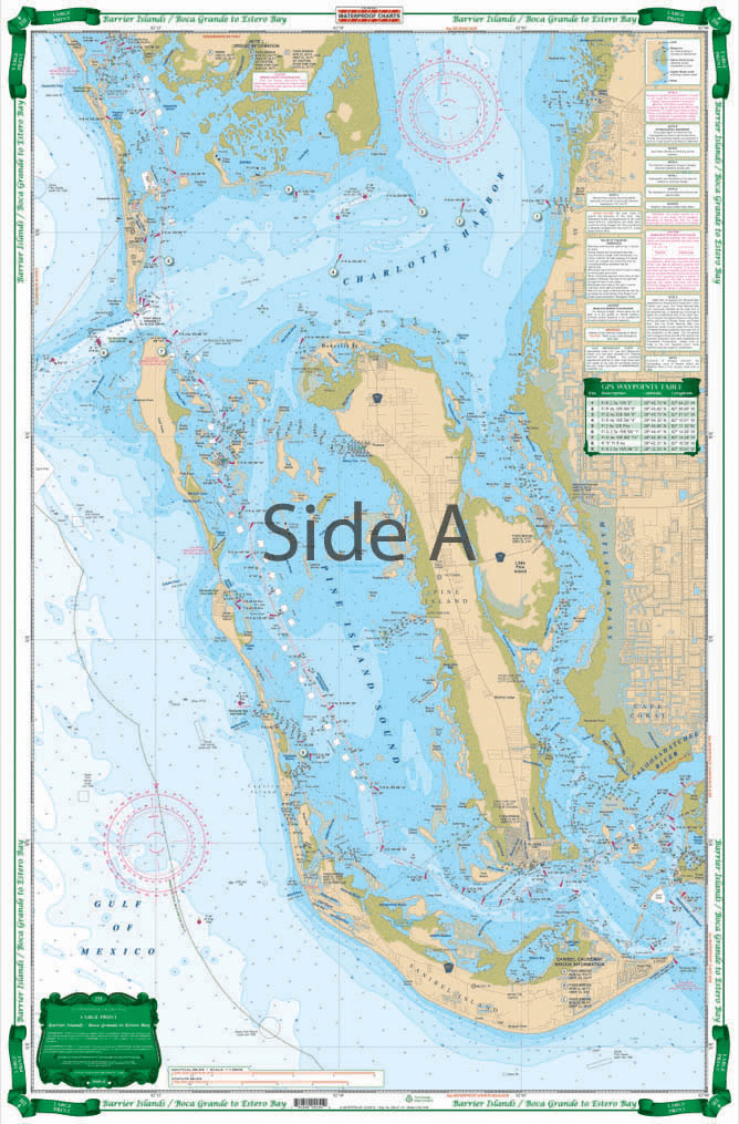
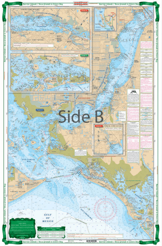

Very easy to read large print coverage of Charlotte Harbor, Pine Island Sound, and Matlacha Pass including all of Sanibel. Offshore up to 6 miles. The reverse side is from Ft. Myers Beach and Sanibel up the river to Cape Coral, Ft.Myers, and East Ft. Myers. Detail for Estero Bay and Hancock Creek. Large Place Names and added street names in Cape Coral make it very easy to use. Colored Key makes chart easy to understand. A total of 13 plotted and indexed GPS Waypoints. Don’t think of going out on the water without this Barrier Islands map. The detail and vibrant colors make it perfect for on-the-water use, as well as a handsomely framed piece of art for your office or home wall. Very easy to read large print coverage of Charlotte Harbor, Pine Island Sound, and Matlacha Pass including all of Sanibel. The navigation map doesn’t just hug the shore, it runs offshore up to 6 miles. The reverse side is from Fort Myers Beach and Sanibel up the river to Cape Coral, Fort Myers, and East Fort Myers. Details are included for Estero Bay and Hancock Creek. Large place names and added street names in Cape Coral make it very easy to use, you will know exactly where you are and where you’re going. The colored key makes this nautical map easy to understand. A total of 13 plotted and indexed GPS Waypoints will help you find points of interest. Information from 2 NOAA Charts: #11426 & #11427. Nautical chart is 25″ X 38″. WGS84 – World Mercator Datum.


Exactly what I was looking for. Quick turn around best online price shipped.
My order was filled, shipped and received within a few days. They make beautiful ways to hold my charts down while I am examining and working with them. The chartweights are attractive additions to my navigation tools. I would recommend American Nautical Services very highly.
This is a perfect nautical chart printed on heavy paper. I will be mounting it on my wall. It looks that good!
We’ve used Skipper Bob publications for the East Coast and Bahamas. They work really well and are very easy to use.