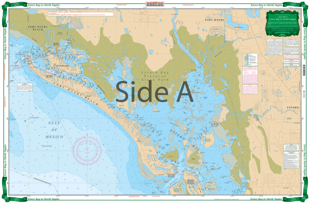
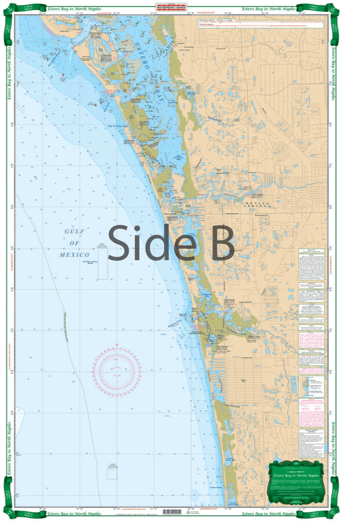

The Estero Bay to North Naples Nautical Chart has detailed coverage of this shallow area with local names and channels. The north side covers Fort Myers Beach, Matanzas Pass, Hurricane Bay, Estero Island and north Estero Bay to Mound Key, including the Hendry Creek, Mullock Creek, the Estero River, Big Carlos Pass, and the Lovers Key State Park area. The south side covers southern Estero Bay, Spring Creek, Fish Trap Bay, New Pass south thru Bonita Beach and the Vanderbilt Channel and Outer Clam Bay. Continues south thru inside route behind Wiggins Pass with complete marker detail and south to the Vanderbilt Beach waterways and canals. Extensive field work details channels and markers available from no other source. Information from county sources, NOAA charts, USGS topographical maps and local experts. Beautiful colors make it suitable for framing. WGS84-World Mercator Datum.


I had a great experience with ANS!
My charts were delivered super quickly, and their customer service was excellent—very responsive and helpful with any questions I had. Highly recommend them for anyone needing quality charts with fast and friendly service.
D.O.T. Chart 17 - Hazardous Materials Markings Labeling and Placarding Guide
Product exactly as advertised, order filled speedily, product arrived in excellent condition.
Exactly what I was looking for. Quick turn around best online price shipped.
My order was filled, shipped and received within a few days. They make beautiful ways to hold my charts down while I am examining and working with them. The chartweights are attractive additions to my navigation tools. I would recommend American Nautical Services very highly.