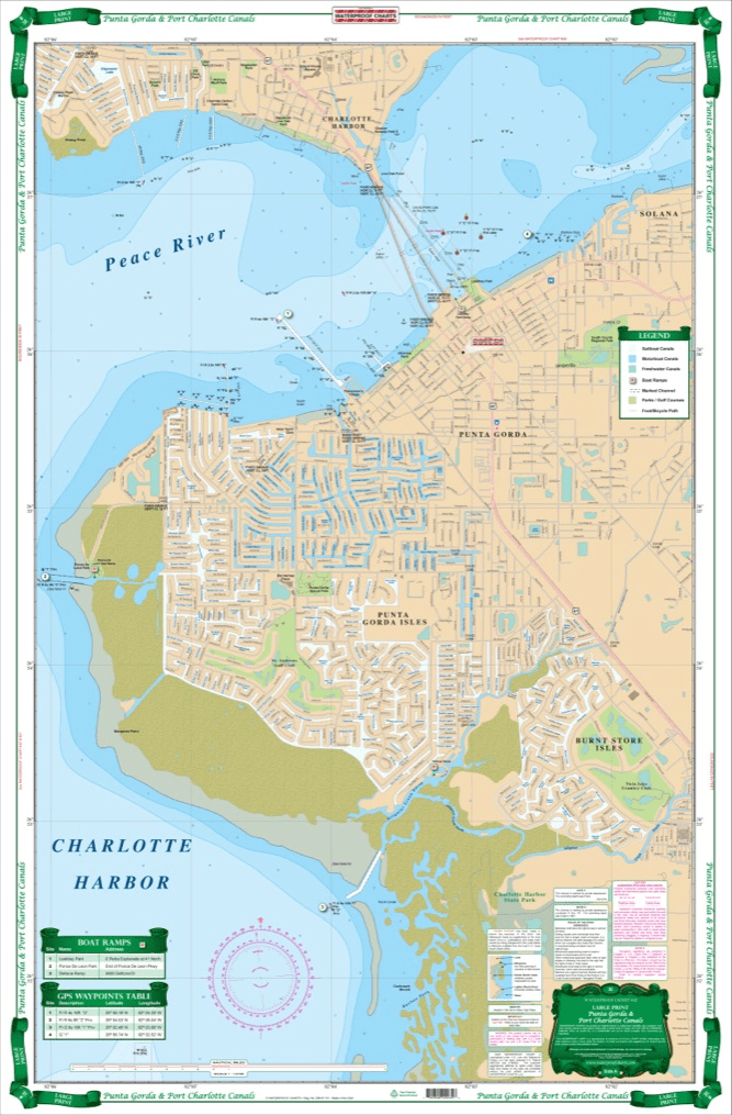
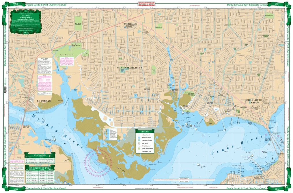

Coverage available from no other source. Current information compiled from Charlotte County GIS, USGS topographic data and NOAA charts. Detailed coverage of both city and county canal systems and the head of Charlotte Harbor and the Mayakka River up to the El Jobean Bridge with current channel entrances, waterway names and bridge and lock information. Defines sailboat (no bridges) and powerboat only waterways with different colors. Easy to read with great colors, suitable for framing. If you live in or visit this area, this is the one chart to have. Coverage like this is available from no other source. Every one of our navigation charts are created from a variety of sources like NOAA charts, government data, and locals. This Port Charlotte map is no exception. Current information has been compiled from Charlotte County GIS, USGS topographic data and NOAA charts. Detailed coverage of both city and county canal systems and the head of Charlotte Harbor and the Mayakka River up to the El Jobean Bridge with current channel entrances, waterway names and bridge and lock information. Our chart defines sailboat (no bridges) and powerboat only waterways with different colors. Easy to read, with great colors that make this nautical map suitable for framing. If you live in or visit this area, this is the one chart to have. Nautical Chart is 25″ X 38″. WGS84 – World Mercator Datum.


Exactly what I was looking for. Quick turn around best online price shipped.
My order was filled, shipped and received within a few days. They make beautiful ways to hold my charts down while I am examining and working with them. The chartweights are attractive additions to my navigation tools. I would recommend American Nautical Services very highly.
This is a perfect nautical chart printed on heavy paper. I will be mounting it on my wall. It looks that good!
We’ve used Skipper Bob publications for the East Coast and Bahamas. They work really well and are very easy to use.