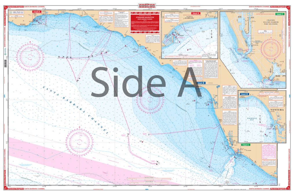
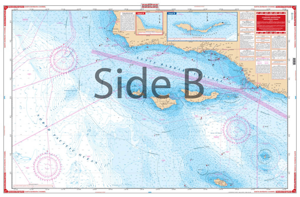


Covers the offshore area from Purisima Point southeast along the coast to Pt. Dume, south offshore to San Nicolas Island, and west to 121 degrees, 40 minutes west longitude. The reverse side details the coastal area from Santa Barbara Point to Port Hueneme. Detailed harbor blow-ups are included for Channel Islands Harbor, Ventura, Santa Barbara, Anacapa Island and Prisoners Harbor. Fueling facilities indicated. Navigate your vessel through the Santa Barbara Channel with ease using this navigation map. It covers the offshore area from Purisima Point southeast along the coast to Pt Dume, south offshore to San Nicolas Island, and west to 121 degrees, 40 minutes west longitude. The reverse side details the coastal area from Santa Barbara Point to Port Hueneme. Detailed harbor blow-ups are included for Channel Islands Harbor, Ventura, Santa Barbara, Anacapa Island and Prisoners Harbor. Fueling facilities are conveniently indicated to ensure you always have a full tank. The vibrant colors of this marine map make it excellent for framing for your home or giving as a gift. Information from 3 NOAA charts: #18720, #18729, and #18725. Nautical Chart is 25″ X 38″. WGS84 – World Mercator Datum.


Exactly what I was looking for. Quick turn around best online price shipped.
My order was filled, shipped and received within a few days. They make beautiful ways to hold my charts down while I am examining and working with them. The chartweights are attractive additions to my navigation tools. I would recommend American Nautical Services very highly.
This is a perfect nautical chart printed on heavy paper. I will be mounting it on my wall. It looks that good!
We’ve used Skipper Bob publications for the East Coast and Bahamas. They work really well and are very easy to use.