Coverage
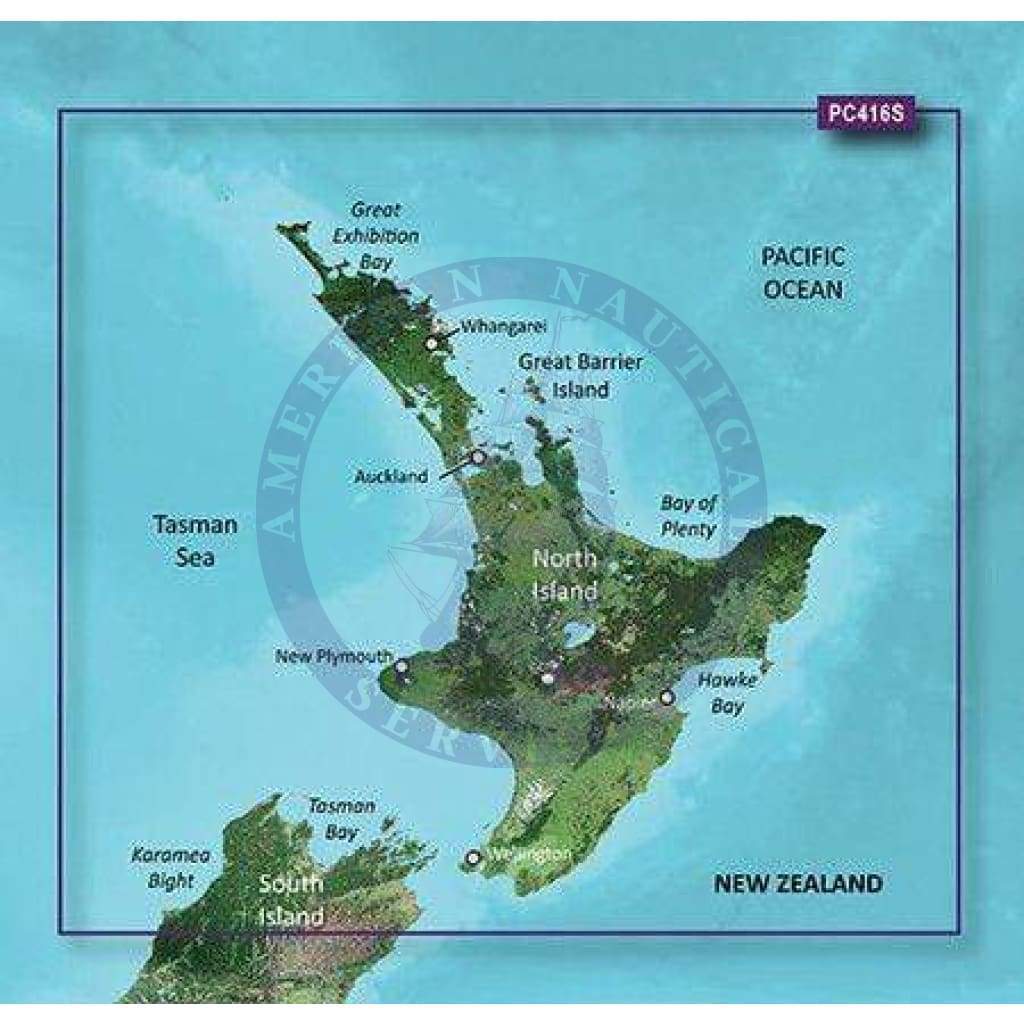
Includes the entire coast of the North Island, including the Three Kings Islands; also includes the northernmost part of the South Island, from Cape Foulwind to Cape Campbell, including Nelson.
BlueChart G2 Visition Features
See your vessel’s precise, on-chart position in relation to navaids, coastal features and restricted areas with premium features found in this detailed marine mapping data. Includes all of the features of our BlueChart® g2 HD product, plus 3-D perspective above and below the waterline, Auto Guidance, high-resolution imagery, and aerial photos of ports, harbors, marinas and landmarks.
- Shaded depth contours, coastlines, spot soundings, navaids, port plans, wrecks, obstructions, intertidal zones, restricted areas and IALA symbols.
- Features up to 1-foot HD fishing contours which reveal detailed seafloor terrain.
- Seamless transitions between zoom levels and more continuity across chart boundaries.
- High resolution satellite imagery for a realistic view of the land and water.
- Aerial photos of ports, harbors, marinas, waterways, navigational landmarks and other POIs.
- Patent Garmin Auto Guidance technology is now capable of providing routing guidance¹ to virtually any accessible destination on the water.
- Mariner’s Eye view 3-D perspective for a quick, easy position fix.
- Fish Eye view 3-D perspective for an underwater view of the sea floor.
- Safety Shading* enables contour shading for all depth contours shallower than your defined safe depths.
- Fishing Charts* to scope out bottom contours and depth soundings with less visual clutter on the display.
- Plan and organize routes from your computer with HomePort™.