Colección: A1 Nautical Charts - The World Index of Charts

A1 Nautical Charts - The World Index of Charts at 1:3,500,000 Scale are print-on-demand (POD) and are fully up-to-date with the latest NTM corrections available. The Admiralty's standard nautical paper charts comply with Safety of Life at Sea (SOLAS) regulations and are ideal for professional, commercial, and recreational use.

(These charts are also known as UKHO - United Kingdom Hydrographic Office Paper Charts and British Admiralty (BA) Paper Charts)


Click here for our Interactive Nautical Paper Chart Finder!

(Select the chart publisher and scale on the left hand side to see charts)

Filter by
11 de 100 productos
South China and Eastern Archipelagic Seas South China and Eastern Archipelagic Seas Borrar todo
British Admiralty Nautical Chart 4507: Philippines to Bismarck Archipelago
Precio
$55.95
British Admiralty Nautical Chart 4508: Pacific Ocean, South China Sea
Precio
$55.95
British Admiralty Nautical Chart 4509: Western Portion of Japan
Precio
$55.95
British Admiralty Nautical Chart 4521: Hawaiian Islands to Minami-tori Shima
Precio
$55.95
British Admiralty Nautical Chart 4603: Indian Ocean, Australia – North Coast and Adjacent Waters
Precio
$55.95
British Admiralty Nautical Chart 4605: New Zealand to Fiji and Samoa Islands
Precio
$55.95
British Admiralty Nautical Chart 4617: Pacific Ocean, Tuvalu to Palmyra Island
Precio
$55.95
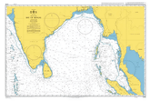
British Admiralty Nautical Chart 4706: Bay of Bengal
Precio
$55.95
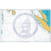
British Admiralty Nautical Chart 4707: Maldives to Sumatera
Precio
$55.95
British Admiralty Nautical Chart 4708: Indian Ocean, Australia West Coast
Precio
$55.95
British Admiralty Nautical Chart 4809: Hawaiian Islands
Precio
$55.95