


Product exactly as advertised, order filled speedily, product arrived in excellent condition.
Exactly what I was looking for. Quick turn around best online price shipped.
My order was filled, shipped and received within a few days. They make beautiful ways to hold my charts down while I am examining and working with them. The chartweights are attractive additions to my navigation tools. I would recommend American Nautical Services very highly.
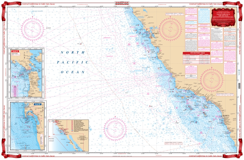
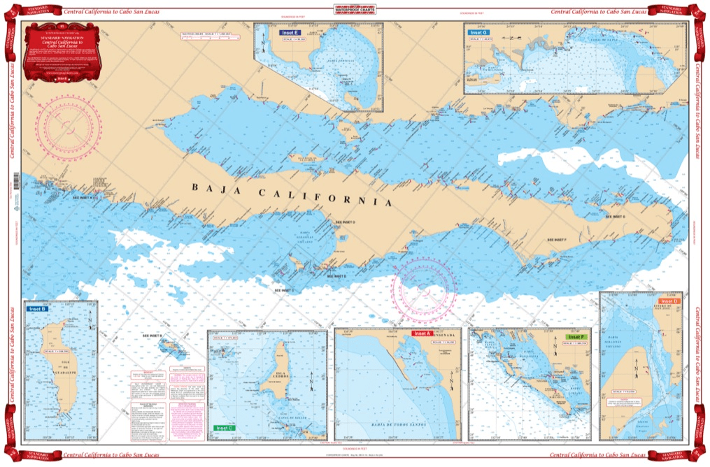
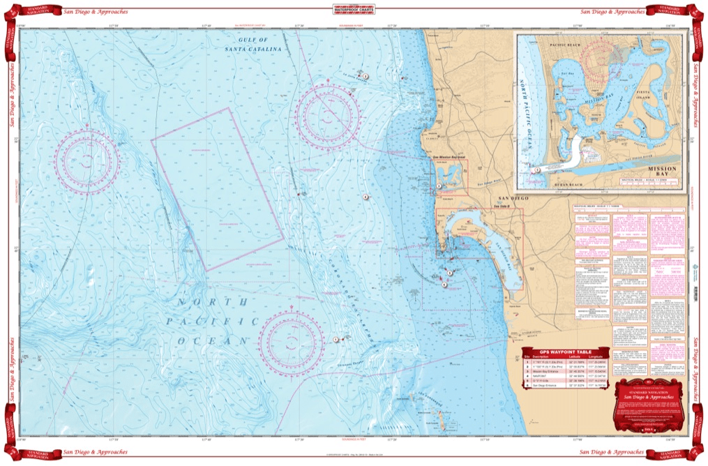
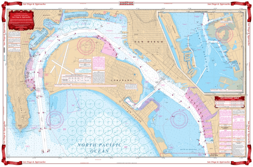
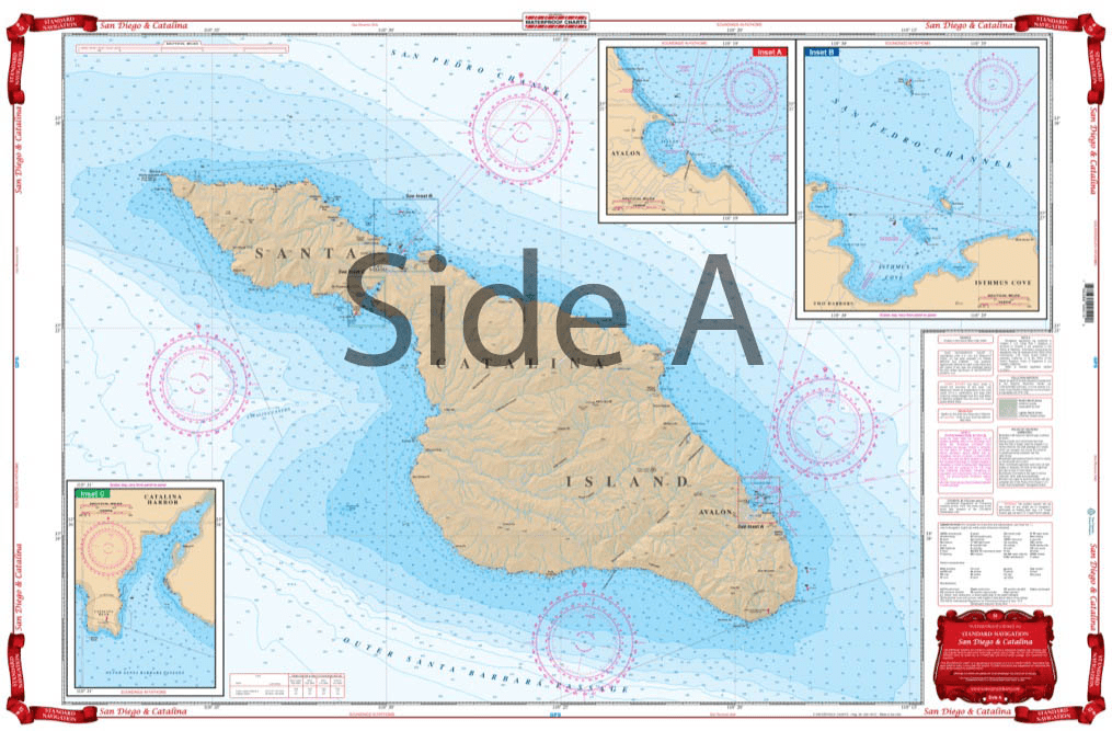
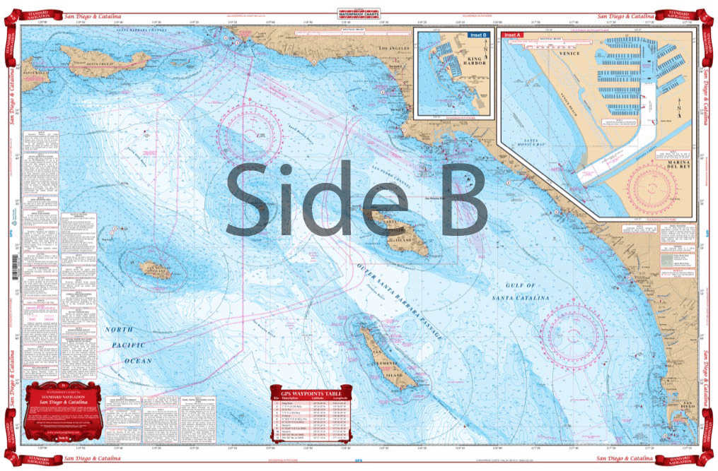
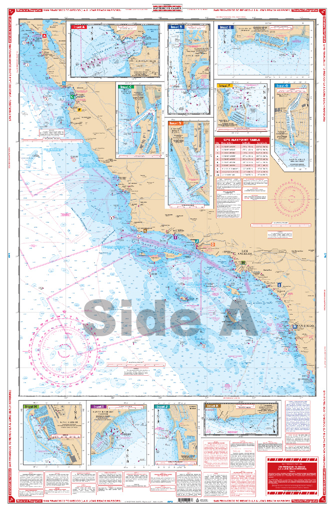
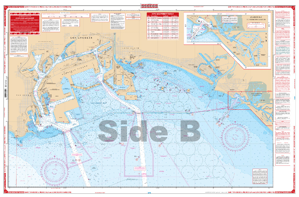
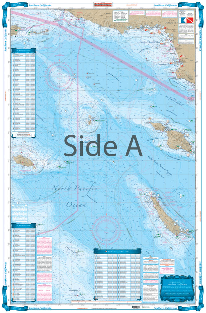
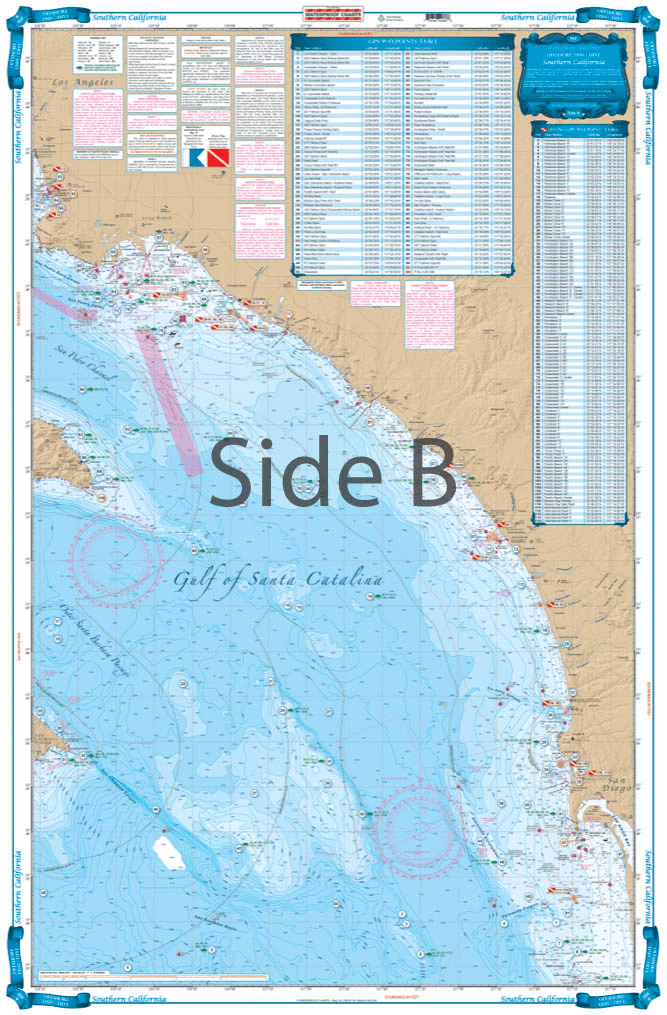
This is a perfect nautical chart printed on heavy paper. I will be mounting it on my wall. It looks that good!