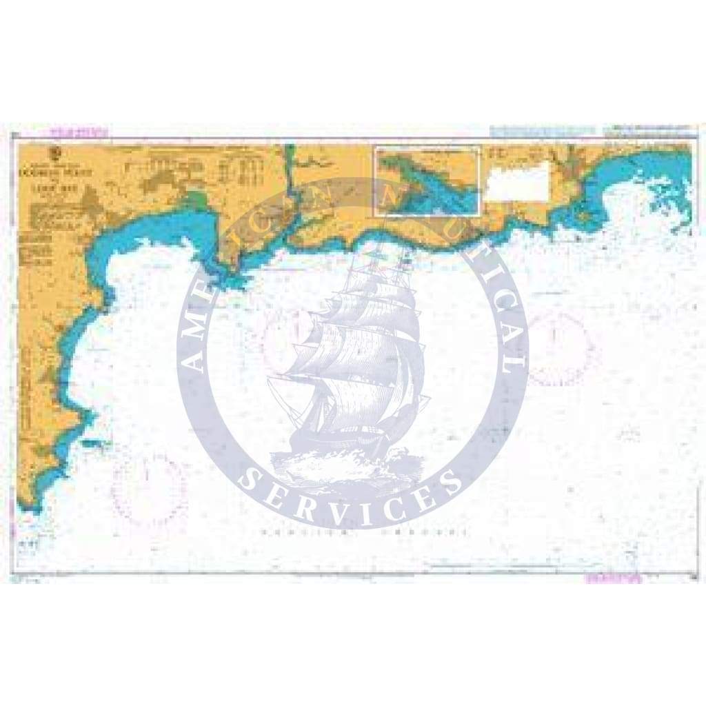
The British Admiralty Nautical Chart 148: England - South Coast, Dodman Point to Looe Bay is an essential tool for mariners navigating this picturesque region. Produced by the United Kingdom Hydrographic Office, this chart meets the stringent Safety of Life at Sea (SOLAS) regulations, ensuring that you have a reliable resource when out at sea. Ideal for both professional and recreational use, this chart supports safe and efficient navigation through varied coastal waters.
Key features of the British Admiralty Nautical Chart 148 include:
- Updated and corrected according to the latest Notices to Mariners (NTM) for your safety.
- Comprehensive coverage of Dodman Point to Looe Bay, including details for safe entry into Polperro Harbour.
This nautical chart is designed for various maritime activities, whether you are planning a passage, undertaking ocean crossings, or simply exploring the beautiful coastlines. It provides a range of scales that are perfect for detailed coastal navigation and efficient route planning.
Given the complexities of busy waterways like the south coast of England, this chart is invaluable. It assists mariners in making informed decisions and enhances their understanding of the navigational challenges they may encounter.
Using the largest scale nautical chart as required is highly recommended for best practices in safe navigation. While this chart provides comprehensive information, mariners should remain vigilant and keep their charts updated for optimal navigational safety.